9 hours ago
About sharing
In a school playground squeezed between two main roads, children play tag in some of Sheffield’s filthiest air.
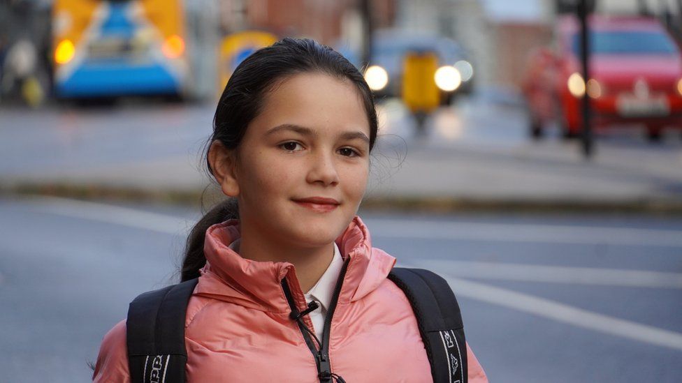
Keisi Hoxhaj, 11, says her morning walk is “really busy and full of pollution”.
Traffic is the main cause, but the situation isn’t helped by a lack of trees to soak up the fumes.
A new interactive map released on Tuesday starkly lays out what has been long suspected, that “concrete jungles” devoid of tree cover have more pollution and poorer air quality.
By a fence at the school, Lowfield Primary, stands a young rowan tree. It was planted by pupils after campaigning by Head of Safeguarding Jo Quinlen.
Almost shouting over the din of trucks and buses, she explains why trees come under her remit.
“We’re in the inner city with very little green spaces and I’m very conscious that that could be affecting the health of our children as they play out in both of our playgrounds,” she said.
She says planting trees is an “essential part of the battle against pollution”.
“We’re doing it as something which we feel is essential to improve that air quality… It’s not just so they are pretty, it’s so our school can be a healthier and nicer place to be.”
The interactive map by the Woodland Trust, American Forests and Centre for Sustainable Healthcare covers urban areas of the UK where more than 50m people live – roughly 80% of the population.
It uses new tree canopy data from Google and six climate, health and socioeconomic indicators to generate a score out of 100 for most urban neighbourhoods in the UK, known as the “tree equity score” (TES).
The map’s creators say the lower the score, the greater the need for more trees.
It suggests that those living in the most deprived areas have less than half the tree cover, and almost 20% more air pollution from traffic in the form of nitrogen dioxide (NO2), than the least deprived neighbourhoods.
It also reveals that on the hottest summer days, UK-wide, the most deprived neighbourhoods are nearly a degree warmer than average – a concern as the climate heats.
By contrast, where tree cover per person is highest, people have around 30% less NO2 pollution, and are 4C cooler during a heat wave than neighbourhoods with the fewest trees per person.
This stark difference must be tackled, according to Catherine Nuttgens, urban lead for the Woodland Trust.
“The way that trees are distributed is unfair… It’s often the university-educated middle classes who have access to lovely leafy suburbs. It’s not that people that live in less affluent areas don’t like trees, they love trees, but they don’t have access to them.”
The Woodland Trust believes that people living in those areas aren’t reaping the benefits of trees – potentially exacerbating social inequalities.
“The benefits of trees and the way that they make people feel, the way that they slow down flooding, the way that they shade areas where we are getting increasing heat – that should be for everyone,” she said.
The map’s creators hope it will inform policymakers in the UK, encouraging them to view trees in our towns and cities as “critical infrastructure” as vital to daily life as electricity and water supplies – which everyone has the right to access.
The idea behind so-called “tree equity” was two years ago by not-for-profit organisation American Forests. It has now received funding as part of $1bn of public money being granted to projects targeting urban tree planting in areas of greatest need.
In Detroit, Michigan, a city ravaged for decades by the collapse of heavy industry, these are often the more deprived areas of the city. They historically also have fewer trees.
Here, not only has the project led to more trees, but also to jobs planting them.
Tyree Perkins was struggling to find work before he joined the Detroit Tree Equity Partnership (DTEP).
“The job changed my life personally by keeping me motivated, I’m around a good environment and every day I am doing something different but it’s positive.”
In the UK some councils, including Birmingham and Belfast, are already looking at the link between urban tree cover and deprivation in their strategies. But the map’s creators hope that the TES will provide a uniform index to encourage all authorities to prioritise where to plant street trees.
Back at Lowfield Primary School, a handful of children gather around their new rowan, growing out of a hole cut in the artificial grass.
Surrounded by thick wooden support posts, it’s still just a sapling and even small hands can wrap around the entire trunk.
One girl tells us she’d like to see “a hundred million more” – but at least this is a start.
