1 hour ago
About sharing
Parts of the UK are poised for heavy rain and flooding over the next few days ahead of the arrival of Storm Ciarán later this week.
Flood warnings are in place across parts of England, Scotland and Wales, while there are also yellow rain warnings for some of Northern Ireland.
Ciarán is set to bring strong winds and heavy rain to southern England and Wales when it arrives on Thursday.
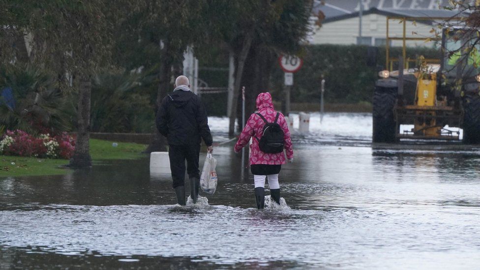
It comes after a number of areas in the UK faced flooding over the weekend.
Forecasters warned that saturated ground conditions caused by the persistent wet weather will increase the risk of flooding.
The Environment Agency urged the public to take care on coastal paths and promenades.
The agency also advised against driving through flood water, saying that just 30cm (11.8 inches) of flowing water was enough to move a car.
Met Office Deputy chief meteorologist Chris Almond said winds brought by Storm Ciarán are “likely to gust to 80mph along the south coast of England, with a small risk of somewhere exposed seeing 90 mph, and winds could even gust up to 50 or 60 mph further inland”.
Almond said this deep, low-pressure system will “bring heavy rain to much of the UK, but the heaviest rain is expected in southern and western areas with 20 to 25 mm quite widely across the region but up to 40 to 60 mm potentially over higher ground”.
“Heavy and persistent rain will fall on to already saturated ground bringing a risk of further impacts such as flooding in areas that are already struggling to clean up from the heavy rainfall we have seen over the last week or so,” he added.
Met Office meteorologist Marco Petagna said various warnings have been in force across the UK and “plenty more” will be issued for the next couple of days.
He said that Tuesday will also be unsettled but quieter before heavy winds and longer spells of rain develop on Wednesday night into Thursday.
“There are possible gusts of 80 to 90 miles an hour in some exposed southern areas. It’s probably quite a nasty storm this one,” Mr Petagna explained.
Homes were evacuated and shops were damaged after a village in County Durham was deluged by “several feet of water” over the weekend.
In Hastings, East Sussex, a shopping centre was evacuated after flood water ripped through one of its entrances.
On Sunday, a caravan park in Bognor Regis was submerged underwater. The town’s Tesco supermarket car park was flooded, and a house roof was ripped off in heavy winds residents described as like a “tornado”.
Related Topics
7 hours ago
13 hours ago
1 day ago